

Frantic preparations wreaked a bit of havoc on the room...

Day 2 of BorderVenture (no pictures from Day 1 because the camera got a bunch of sand in it and wouldn't work). I was staring at that mountain range for most of the day (the southern end of the Huachuca's, I believe), knowing that I would eventually have to go through them.

A transition in the wall material and construction, getting closer to the San Pedro River

Finally arrived at the San Pedro River. It was a distant green band through a much drier landscape for quite a while. Thankfully they only extended vehicle barriers through the riparian area rather than the full wall. Not that the wall would have been able to stand for very long in the river without some serious engineering anyway.

Though it may appear to be a small stream to anyone coming from a place that has water, this is certainly a river by Sonoran standards, and I'm sure is quite impressive when a monsoon storm unleashes. I spent a good 30 minutes here, not wanting to leave the shade of the mesquite and cottonwood trees and the cool water.

A beautiful landscape to behold on the other side

And behold the sweet irony of the border wall. If for some reason you couldn't climb it (damn near anyone could), you can just walk right around it- though you might have to lift your leg about knee height here. Finally getting into the mountains here, where it likely became too difficult and expensive to continue the wall. Shortly after this the vehicle barrier stopped and the border was demarcated only by a barbed wire fence.

Just a particularly pretty tree on the mountainside.

A small barricade built under a tree, likely used by both migrants and drug smugglers to hide from observers in helicopters. I saw many of these scattered all over the mountainside, under trees, in washes, under large boulders, etc. Often there were many water bottles, miscellaneous other containers, clothing, and other items left behind by people passing through.

After bailing down off the side of the first mountain to get water from a horse pasture in Mexico, I found myself onto what was obviously a migrant path. I walked for a couple more hours through dusk and into the night, and eventually came upon this memorial to some who had died attempting to cross the desert. The candles inside were all lit, and near the memorial there was over a hundred spent candles. Someone still cares greatly for these people- this was as close to the middle of nowhere as you can get these days. The border militarization is killing people.

Day 3 of BorderVenture. No more wall, just vehicle barriers and fencing. Many fewer Border Patrol agents in this region, only saw three the entire day. This was a very large basin of high elevation prairie. Quite beautiful, though a little hot and dry.

Rolling hills, open prairie, big trees and draws, isolation, and achilles pain were the name of the game this day.

Some of the biggest Cottonwood trees I've ever seen, just inside the "town" of Lochiel. It was a Port of Entry until about 30 years ago, and my guess is that it had a little more traffic and people back in those days. I didn't see anyone when I passed the dozen or so homes collected there, but it was obvious that people still live there. I can't tell you how isolated this place is. The nearest town is Nogales, connected by about a 40 mile dirt road that crosses through a rugged mountain range.

A view of Nogales from the family's house I stayed at for two evenings. I crossed the mountains on the Mexican side of the border because there was a "highway" (dirt road) that allowed more direct and easy travel than bushwhacking my way there, but I ended up hitchhiking the last 15 or so miles to town due to achilles pain. The fourth person to pass picked me up, and refused to take any money when they stopped. They certainly wouldn't have had similar experience were they in my situation on the U.S. side of the border, even if they were legal citizens. I was overwhelmed by kindness while in Nogales.
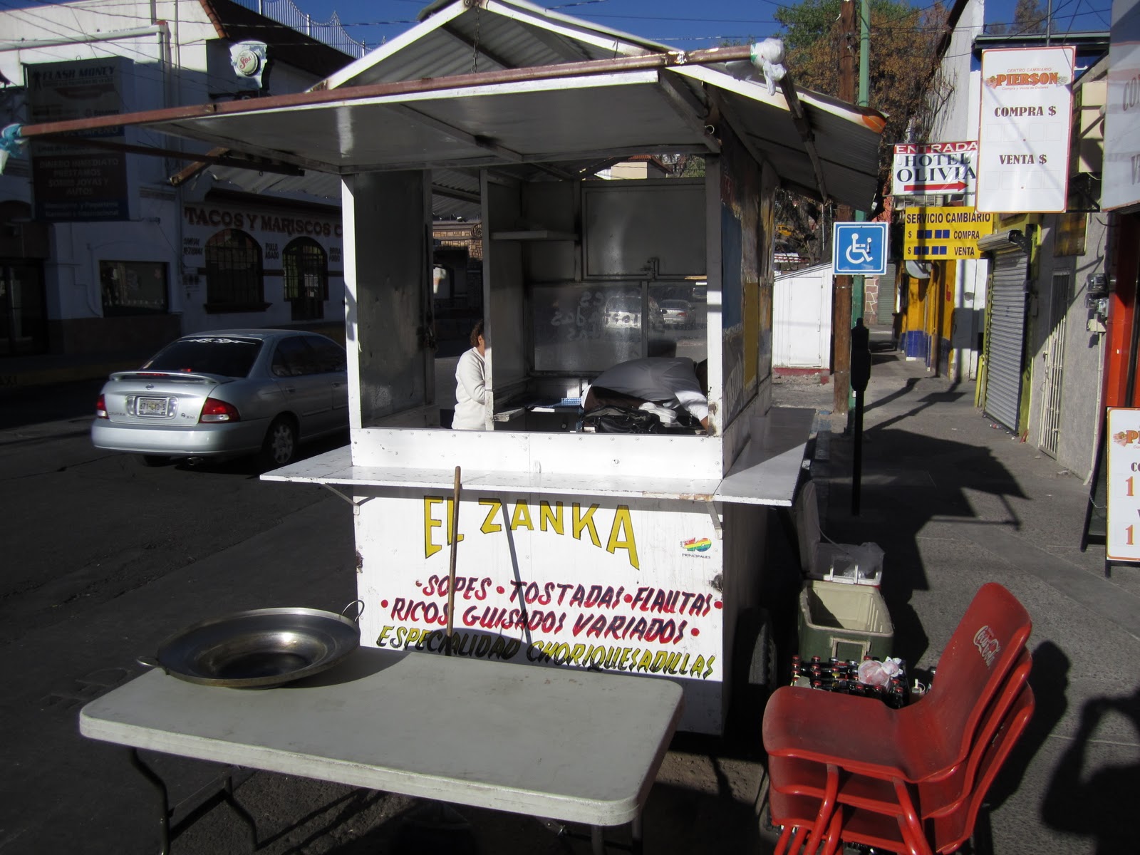
El Zanka, the street cart run by Rosie and her family. If you're ever in Nogales, make sure to stop by and order one of the legendary Choriquesadillas. They are only a few blocks south of the Port of Entry, but most of their business seems to come from locals working in the area. Since the border became so much more of a hassle to cross and gross exaggerations of violence were echoed through the U.S. media, the businesses here get little of the tourism that many had come to depend on for income.
In bringing attention to the border, and the wall, you are doing important work. For more background info., visit the No Border Wall website:
ReplyDeletehttp://www.no-border-wall.com/
and the Sierra Club's Borderlands Team site:
http://sierraclub.org/borderlands/
Good luck, and keep in touch.